Overeye: UK drone survey, LiDAR & inspection services
We survey and inspect the places that are hard to reach.
Survey and inspection data for roofs, façades, bridges, confined spaces and live sites, captured by drone and delivered ready to use. Plus independent consultancy for organisations bringing drones in-house, from business case to CAA permissions.
01 · Survey & inspection
From a single roof to critical infrastructure
One roof or a national network, every job gets the same planning, safety case and standard of data. See all services
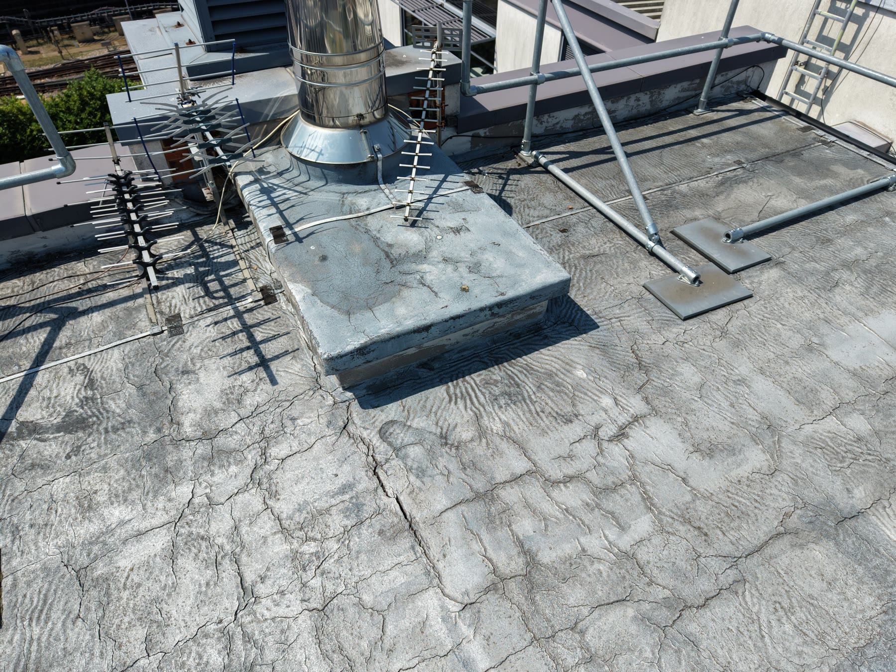 Roof inspectionsDefects identified and marked up on high-res imageryCondition evidence for insurers, contractors and maintenanceNo scaffold, MEWPs or working at heightLearn more
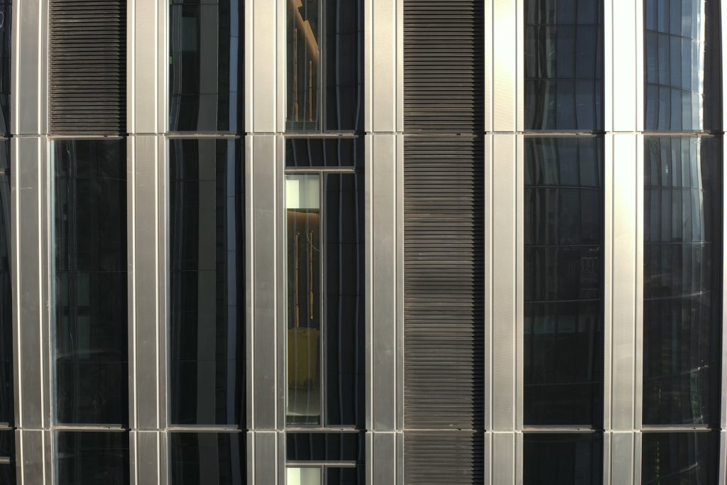 Façade and structure inspectionsFull elevation capture for condition and defect surveysSpot cracking, spalling and failed joints earlyRepeat captures to track change over timeLearn more
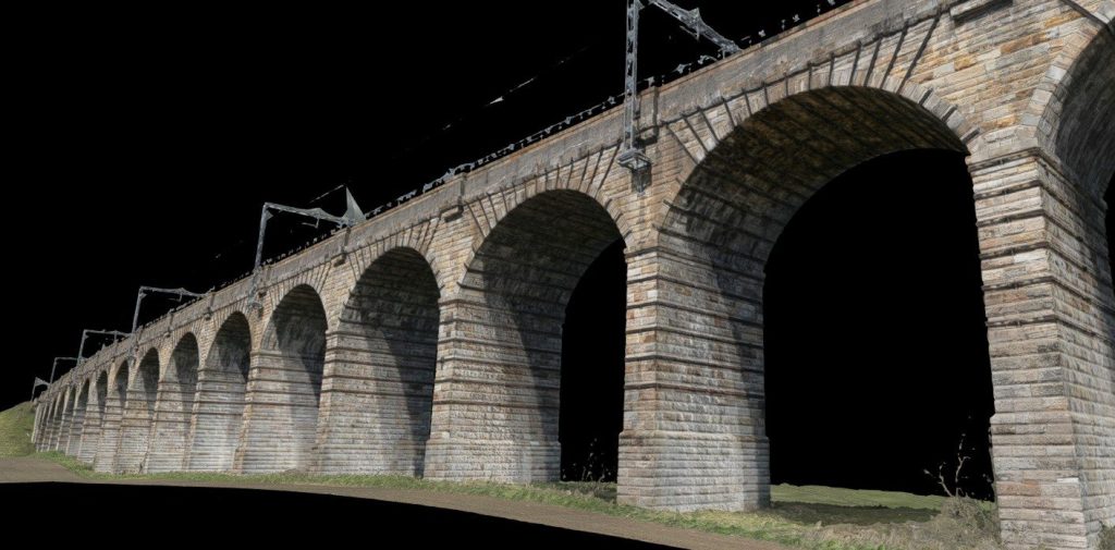 3D models and point cloudsPhotogrammetry and LiDAR models of structures and sitesLiDAR that maps the ground beneath treesReady for CAD, Revit and BIM workflowsLearn more
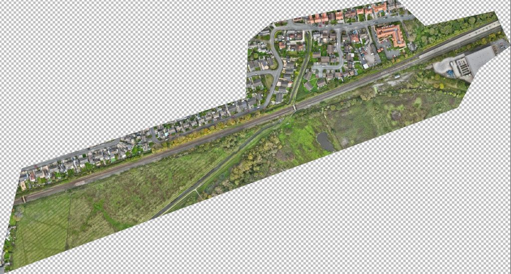 Mapping and orthomosaicsAccurate, scaled orthomosaics and site mapsTerrain models, contours and volumesCorridor mapping for rail, roads and utilitiesLearn more
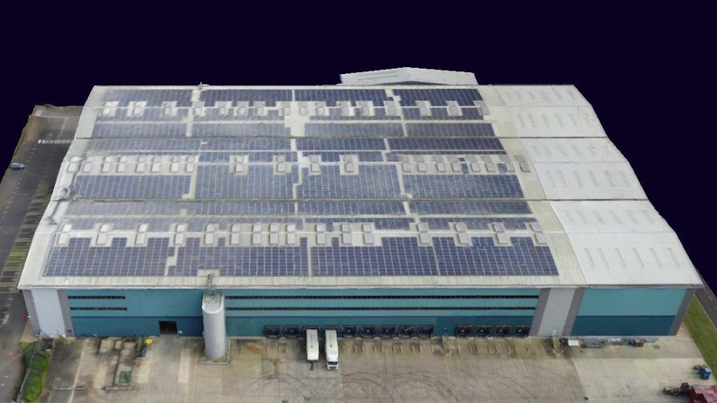 Construction progressRepeatable, visit-by-visit imagery and modelsAn evidential record for clients, disputes and handoverA timeline of the site in one placeLearn more
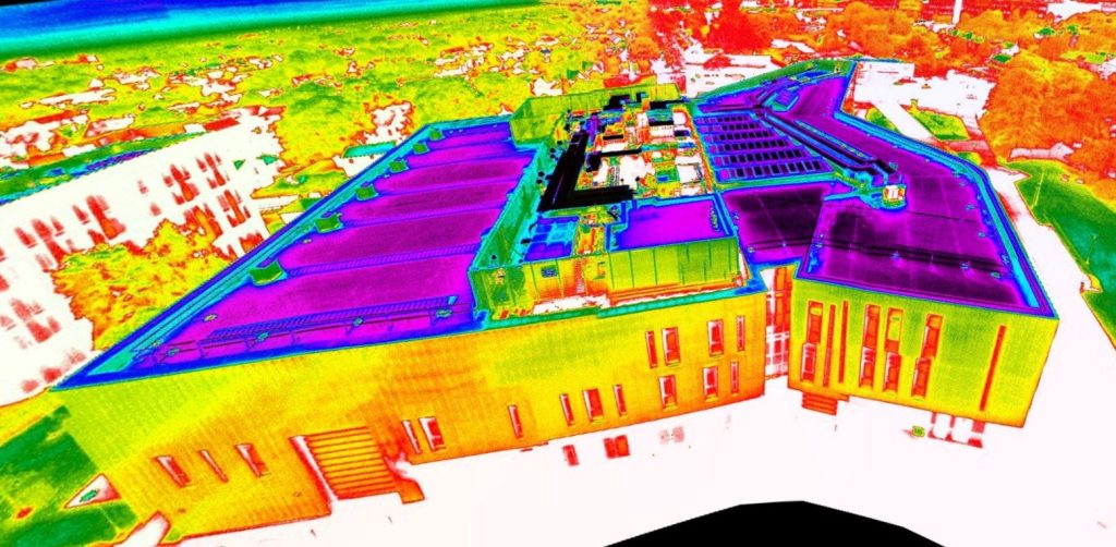 Aerial thermographyHeat loss, moisture ingress and hot spotsRoofs, façades, plant and electrical assetsITC Level 2 thermal reports with annotated findingsLearn more
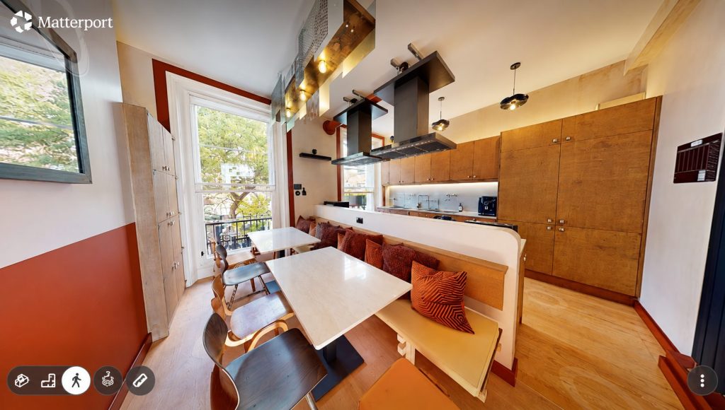 Matterport 3D surveysWalk-through digital twins of building interiorsFloor plans and measured drawings on requestHandover, snagging and marketing recordsLearn more
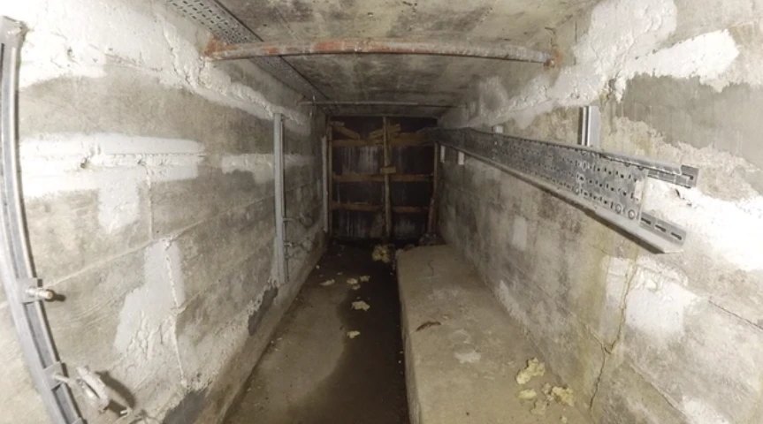 Confined space and internal inspectionImagery and video from spaces people shouldn’t enterLess shutdown time, fewer permits, lower entry riskA record of hard-to-reach internal assetsLearn more
02 · Consultancy
Independent drone consultancy
From “could drones help us?” to “we need an Operational Authorisation”, and everything in between. Our advice is independent and vendor-neutral. If a drone isn’t the right answer, or another route suits you better, we’ll tell you.
Advice from someone who actually flies
A lot of drone consultancy is written from behind a desk. Ours comes from more than a decade of real operations: offshore assets, confined spaces, live railways, multi-arch viaducts and tight urban sites. That means your procedures, risk assessments and SORA application are built around how flights really work on the ground, not just what reads well on paper.
Adopting drone technology
For organisations deciding whether, and how, drones fit.
- Feasibility studies and business cases
- Use-case and return-on-investment assessment across your assets
- In-house, contractor or hybrid: which model suits you
- Tender specifications and supplier evaluation
- Equipment, software and data-workflow selection
Permissions & compliance
For organisations flying, or planning to fly, themselves.
- SORA-based Operational Authorisation applications
- Operations manuals and operational risk assessments
- Airspace, flight restriction zone and site permissions
- Compliance reviews of existing drone operations
- Ongoing regulatory support as your operation grows
Case studies
Recent projects
Rail · StructuresNewbridge Viaduct laser scan and drone surveyA survey-grade digital twin of a 36-arch listed viaduct on a live, electrified mainline.Read case study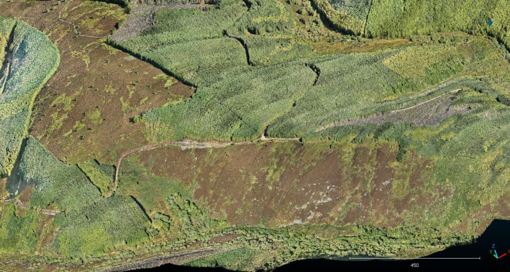 Renewables · LiDARDrone LiDAR survey for wind farm feasibility1,000 hectares of moorland and forestry mapped in days, including the true terrain under the trees.Read case study
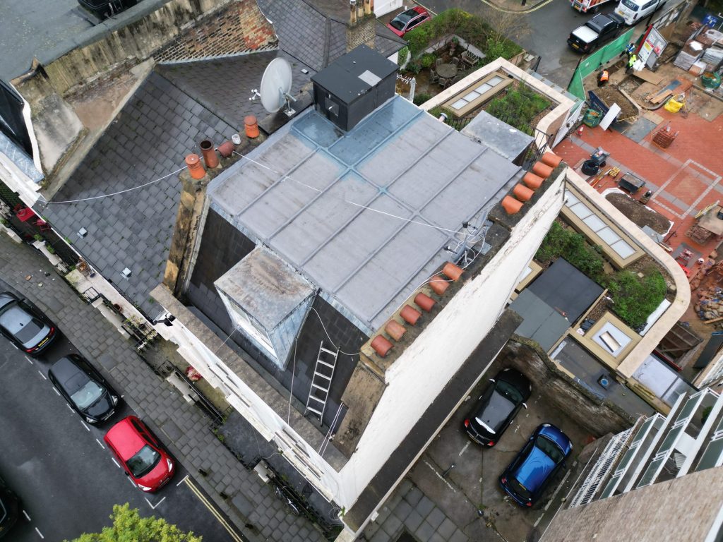 Residential · RoofsRoof inspection & Matterport survey, West LondonCondition evidence before purchase and a digital twin after conversion, for a coliving operator.Read case study
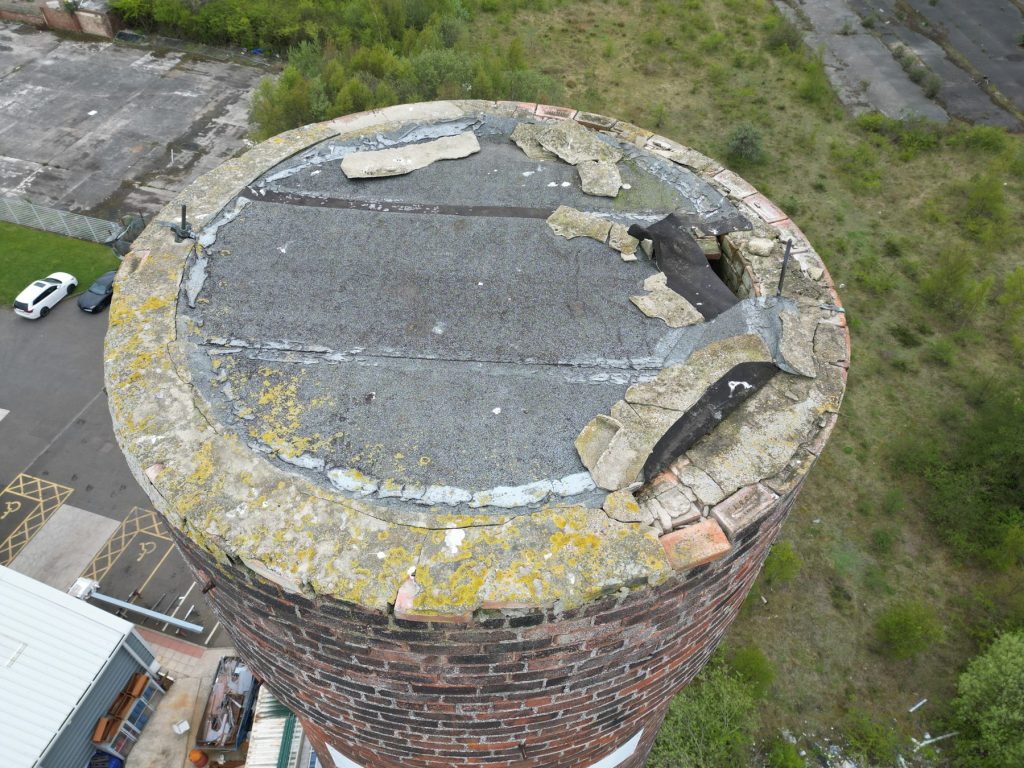 Commercial · StacksChimney stack inspection on a live retail siteA failing capping assessed in high definition, with no MEWP, scaffold or work at height.Read case study
Who we work with
Building surveyors & consultancies
Defensible condition evidence from roofs and elevations nobody can safely reach, marked up and ready for your report.
Condition, dilapidation & defect surveys
Architects & engineers
Measured existing-condition data before design starts, in the formats your team already uses.
Point clouds & 3D models for CAD and Revit
Main contractors & Tier 1s
Inspections and progress records on live sites, planned around your site rules, permits and inductions.
Pre-start surveys, progress & inspections
Asset owners & infrastructure operators
Repeatable condition data across estates, utilities, rail and energy, plus help bringing drone capability in-house.
Maintenance, thermal & asset data
Why Overeye
Why clients use us
The right data, first time, in the form your team actually needs, from an operator permitted to fly where most can’t.
Permission to fly where others can’t
Our enhanced CAA Operational Authorisation lets us fly closer to people, buildings and structures, and further along corridors, than a standard operator. Tight urban sites and long linear assets don’t need workarounds.
HD footage, or a professional opinion
High-definition imagery and 4K video when that’s all you need. Or inspection reports prepared by a building fabric specialist, with RICS surveyors available where your project calls for them.
Faster and safer than scaffold
No scaffold, MEWPs, rope access or road closures. Most inspections are captured in hours rather than days, with no one working at height.
Every visit in one place
Imagery, reports, models and point clouds are delivered through VueSync, so your whole team can review, share and compare visits over time.
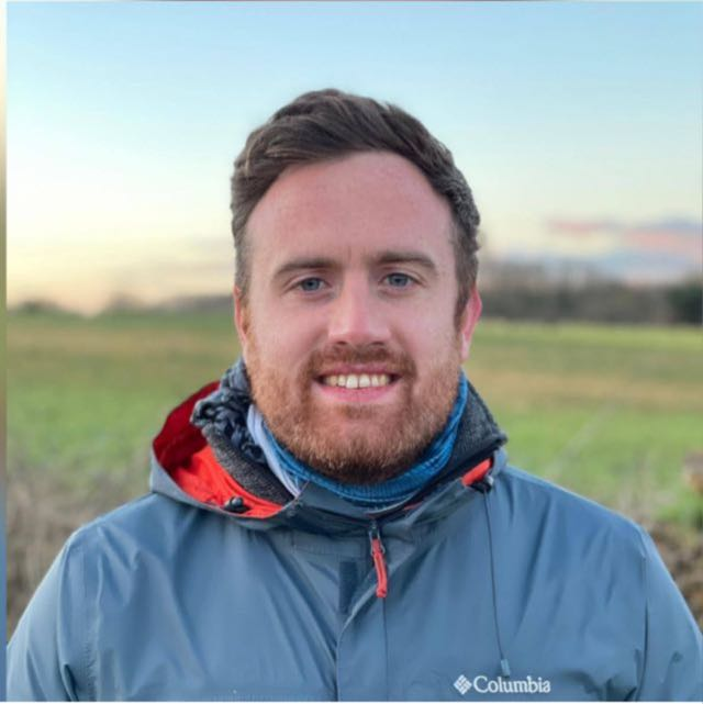
Jon RowlandDirectorConnect on LinkedIn
About
About Overeye
Overeye is a Sheffield-based drone survey, inspection and consultancy company working across the UK, established in 2016. The business is led by Jon Rowland, who has spent more than a decade in the UK drone industry, with a background in aerospace engineering, software and IT project delivery.
Jon has run UAS departments, led training at one of the UK’s largest drone training providers, and logged 1,500+ flight hours across offshore assets, confined spaces, rail structures and multi-arch viaducts, including work under enhanced CAA permissions.
That hands-on experience shapes how we plan every job, and how we advise teams starting out. Clients get more than footage: they get data that is accurate, well organised and ready to use.
How a job runs
Scope and capture
Process and check
Deliver and share
Everything is delivered through VueSync, our client portal.
Common questions
What size of job do you take on?
Everything from a single roof inspection to multi-site and critical infrastructure programmes. We plan the equipment, method and deliverables around the job.
What permissions do you hold?
We operate under a CAA Operational Authorisation based on an Operational Safety Case (OSC), with enhanced permissions that allow longer and closer flights than a standard operator, including on live sites and near occupied buildings. We also hold £5m insurance cover.
What will we receive?
Anything from high-definition imagery and 4K video to inspection reports prepared by a building fabric specialist (with RICS surveyors available if you need them), plus point clouds, 3D models, orthomosaics and thermal findings. Everything is delivered through VueSync.
Is your consultancy independent?
Yes. Consultancy is advice, not a sales route for our survey work. Our recommendations are vendor-neutral, and if a drone isn’t the right answer, or another option suits you better, we’ll say so.
Contact
Talk to us
Tell us about the site and what you need to know. We’ll come back with the right approach and a clear quote.
Prefer a guided brief? Use our two-minute project planner and we’ll come back with the right approach.
We only use your details to respond to your enquiry. See our privacy policy.